
Jomolhari Trek It is the longer of the two Jomolhari routes and the most popular trek in Bhutan. With altitude differences of 2,500 m and nearly 5,000 m (the lowest and highest points of the route), it offers a wide range of landscape, fauna, and flora. The highlight of this trek is the spectacular view of Mount Jomolhari from Jomolhari Basecamp, Jangothang. Nearly the whole trek goes through a small part of the Jigme Singye National Park, passing a few of the Yak herder’s settlement and the remotest region of Lingshi. One should be reasonably physically fit to enjoy the majestic mountain views, endure thin air, serenity & the wilderness of the landscape while on the trek.
CHECK LISTS
Trekking tips and what to bring during the trek in Bhutan
Physical Fitness
Treks vary from short, three-day walks across low altitudes to the three-week Snowman Trek that covers 356 kilometers and climbs three of the Kingdom’s highest passes. Not only the overall duration but also the daily walking distances vary substantially according to the different trek routes.
Trekking Gear
Treks vary from short, three-day walks across low altitudes to the three-week Snowman Trek that covers 356 kilometers and climbs three of the Kingdom’s highest passes. Not only the overall duration but also the daily walking distances vary substantially according to the different trek routes.
Although trekking gear is available in Bhutan, you are advised to bring your own.
What to Bring FOR ALL TREKS
Footwear
Clothing
Other equipment
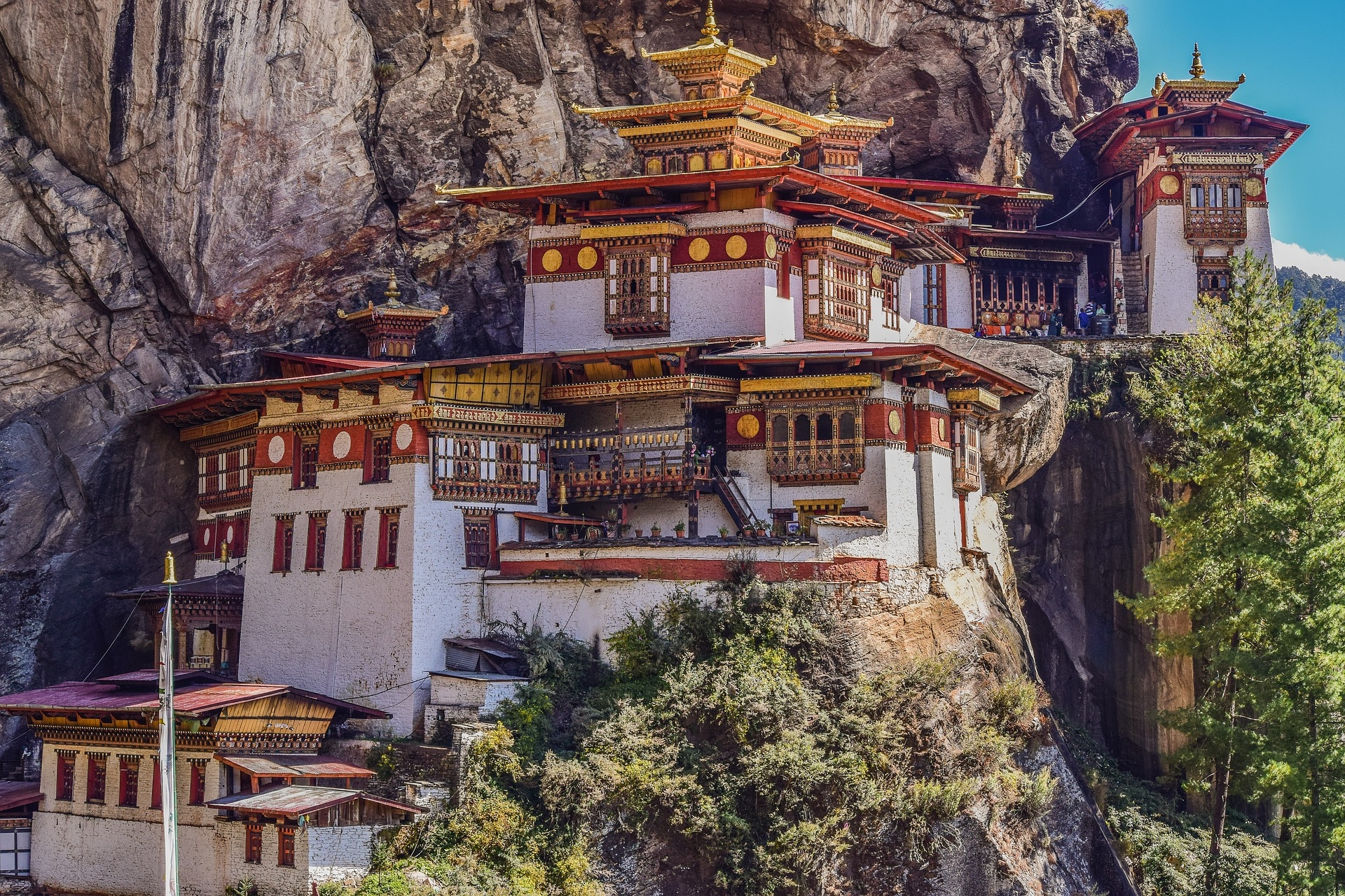
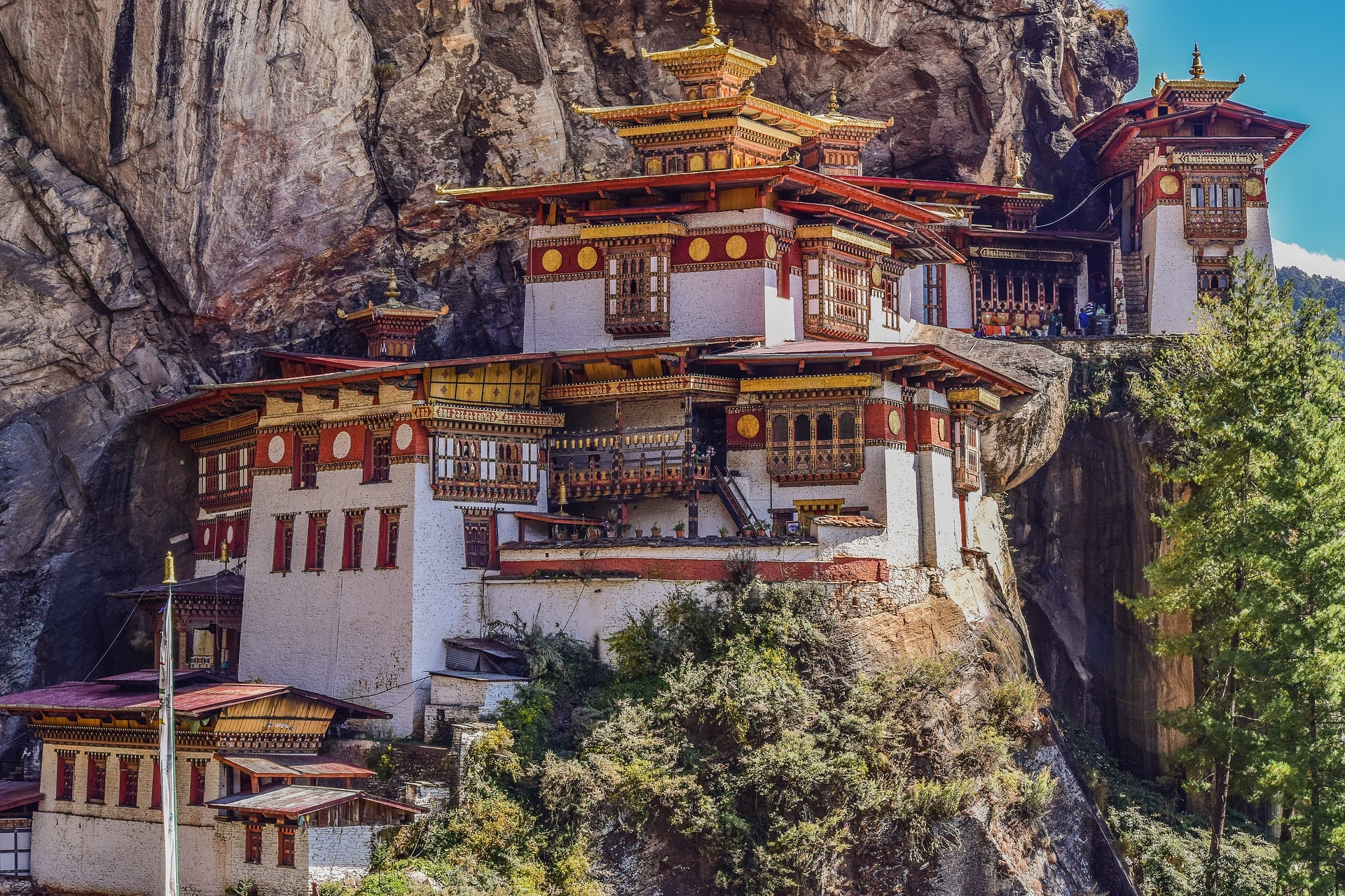
Continue your exploration of Paro with a visit to the Taktsang Monastery, famously known as the Tiger's Nest. Perched on a cliff, this sacred site offers stunning views of the valley. The trek to Taktsang provides both a physical and spiritual experience. In the afternoon, you may choose to explore the local market or relax at your leisure, enjoying the tranquility of Paro.
Overnight in Paro
Embark on the Jomolhari Trek, a thrilling adventure through the pristine landscapes of Bhutan. The journey begins with a gradual ascent, passing through picturesque villages and lush forests. Set up camp for the night, surrounded by the tranquility of the Himalayan wilderness. The first day of trekking allows you to acclimate to the altitude while absorbing the breathtaking beauty of the Bhutanese wilderness.
Overnight in tents
Continue your trek deeper into the Jomolhari region, traversing through alpine meadows and dense forests. Marvel at the majestic Jomolhari peak in the distance as you make your way through this remote and untouched terrain. The day's trek provides an opportunity to connect with nature and experience the unique flora and fauna of the region. Camp overnight in the lap of the Himalayas.
Overnight in tents
As the trek progresses, you will ascend further into the Jomolhari region, encountering pristine lakes and awe-inspiring landscapes. The air becomes crisper, and the panoramic views become more captivating. Take in the grandeur of the surrounding mountains and relish the solitude of the high-altitude wilderness. Camp under the star-lit sky, surrounded by the serenity of the Himalayas.
Overnight in tents
Today's trekking adventure leads you to high mountain passes, offering unparalleled vistas of the Jomolhari range. The challenging yet rewarding terrain showcases the untouched beauty of Bhutan's wilderness. As you continue your journey, the sense of accomplishment grows, and the surrounding peaks become constant companions. Settle in for another night of camping, immersing yourself in the pure mountain air.
Overnight in tents
The trek brings you closer to the base of Jomolhari, and the landscape transforms into a surreal wilderness. Traverse through glacial valleys, rocky moraines, and serene landscapes. The proximity to Jomolhari allows for breathtaking views of this sacred peak. Camp under the shadows of the majestic mountains, surrounded by the beauty of the natural world.
Overnight in tents
Continue your trekking adventure, exploring the alpine terrain and crossing high mountain passes. The rugged beauty of the Jomolhari region unfolds with every step. The tranquility of the surroundings invites moments of introspection and connection with the pristine environment. As the day concludes, camp at a strategic location, providing a perfect vantage point for the surrounding Himalayan peaks.
Overnight in tents
The penultimate day of the Jomolhari Trek offers a mix of challenging ascents and descents, allowing you to absorb the diverse landscapes of Bhutan. Traverse through mountainous terrain, crossing streams and enjoying the ever-changing scenery. The day's trekking adventure culminates in a well-deserved campsite, surrounded by the grandeur of the Himalayas.
Overnight in tents
Complete the Jomolhari Trek with a sense of accomplishment. Descend from the high-altitude wilderness and drive to Thimphu, Bhutan's capital city. As you arrive, explore the vibrant streets and immerse yourself in the cultural ambiance. Visit key landmarks such as the Tashichho Dzong and the National Memorial Chorten. The day concludes with a well-deserved rest in Thimphu.
Overnight in Thimphu
Delve into Thimphu's cultural riches with a full day of sightseeing. Visit the Buddha Dordenma Statue, offering panoramic views of the city. Explore the Folk Heritage Museum and the traditional arts and crafts school. Stroll through the local markets, gaining insights into Bhutanese daily life. In the evening, absorb the city's energy before retiring for the night.
Overnight in Thimphu.
The Jomolhari Trek is a popular trekking route in Bhutan that takes you through stunning landscapes, remote villages, and offers breathtaking views of the majestic Jomolhari mountain (also known as Chomolhari), one of Bhutan's highest peaks.
The Jomolhari Trek typically takes around 8 to 9 days to complete, depending on the specific itinerary and trekking pace. The trek covers a distance of approximately 140 kilometers.
The Jomolhari Trek is considered moderately difficult. It involves trekking at high altitudes, reaching elevations of over 5,000 meters (16,400 feet). Prior trekking experience and good physical fitness are recommended.
The trek offers stunning views of Jomolhari and other snow-capped peaks, passes through alpine meadows, rhododendron forests, and visits remote Bhutanese villages like Jangothang and Lingshi. The trek is a unique opportunity to experience Bhutan's pristine natural beauty and traditional culture.
Bhutan is a deeply cultural and religious country. Respect local customs, avoid disturbing wildlife, and adhere to any guidelines provided by your trekking guides. It's customary to walk clockwise around religious monuments, and it's important to be mindful of the environment.


